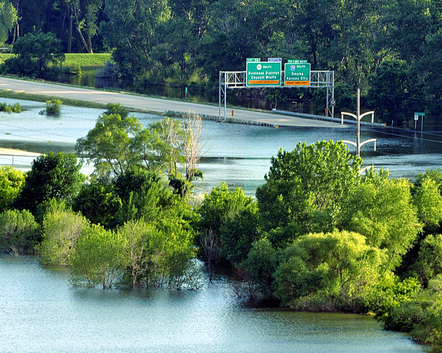
This summer's University of Nebraska water and natural resources tour will spend three days visiting parts of Nebraska and Iowa that were most affected by last summer's record flooding on the Missouri River.
The tour is July 17-19, leaving from and returning to Hardin Hall on the University of Nebraska-Lincoln East Campus at North 33rd and Holdrege streets.
"We'll not only look at residual damage, but just as significantly, restorative efforts since flood waters receded and what we have learned from the actual flood," said Steve Ress, tour co-organizer and communicator at UNL's Nebraska Water Center, part of the Robert B. Daugherty Water for Food Institute.
"The flood disrupted the lives of thousands and extended for more than three months, breaking through levees and flowing beyond vulnerable lowlands to destroy homes, businesses and highways," said tour host and co-organizer Mike Jess, a retired UNL lecturer.
From Decatur to Hamburg, Iowa, tour participants will inspect a variety of locations where the flood's destructive impact will be fully evident.
"Near Tekamah, they will see where over-bank flows attempted to occupy a former river channel last used by the river more than a hundred years ago. We'll also see large tracts of cropland that remain unproductive from accumulations of fine-textured sediment left by the floodwaters," Jess said.
Some of the cropland bordering the river is covered by several feet of fine, blowing sand, resembling pictures from the 1930s Dust Bowl, Ress said.
Salvaging native forests, restoring river habitat and repairing levees and other infrastructure since the flood also will be featured.
Elsewhere, participants will see Omaha's Eppley Airport, where an ambitious water-well dewatering network allowed commercial air traffic to continue unabated throughout the duration of flooding, despite the fact that the airport borders the river.
The tour also will stop at Omaha Public Power District's coal-fired power plant near Nebraska City. There, special pumps, a series of temporary dikes and elevation of a railroad coal supply line permitted uninterrupted production of electricity throughout the flood, Jess said.
Last year's Missouri River basin flooding was caused by a combination of snowmelt in the northern Rocky Mountains and record-setting rainfall runoff in Montana and North Dakota.
The tour is co-sponsored by Omaha Public Power District, U.S. Geological Survey Nebraska Water Science Center, Nebraska Public Power District, Kearney Area Chamber of Commerce, Central Nebraska Public Power and Irrigation District and the Nebraska Water Center.
Registration is $645 single lodging occupancy or $545 per person double occupancy and includes all meals, transportation expenses, activities and lodging in both Omaha and Nebraska City. To register, contact Jennie Nollette at the Kearney Area Chamber of Commerce at (308) 237-3168 or email jnollette@kearneycoc.org.