By Ronica Stromberg
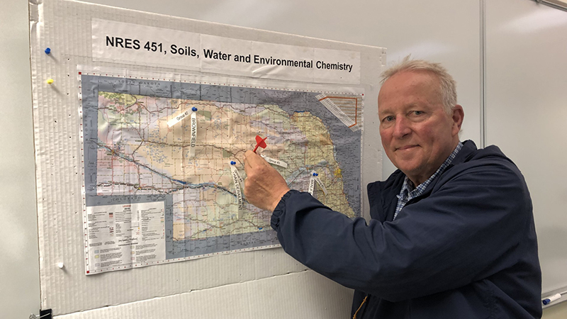
Steve Comfort keeps innovating in his Soils, Water and Environmental Chemistry class even as he approaches retirement. His latest innovation is adding a dartboard to the class.
The soil and water chemist created the dartboard from a map of Nebraska, and students now throw darts at it to choose a site for their final class project. The students also draw from a hat the name of a contaminant, like a leaking storage tank, train derailment or abandoned dry cleaner. They then work in teams of three to look into the hypothetical chemical spill at their site and propose a way to remediate it.
"It's something besides just a PowerPoint presentation," Comfort said in his understated way.
The truth is the professor of more than 30 years did a lot of work to set up this final project that gives students true-to-life experience working on a team charged with remediating a contamination problem. For every spot where a dart could land on the map, students needed to be able to figure out which way the groundwater was moving and how fast. Comfort knew students could get these groundwater values through the ArcGIS software, but having graduated from college in the 1980s, he had never been trained in ArcGIS himself. The professor headed back to the classroom in 2023 as a student, taking a graduate course in ArcGIS Pro.
The project he carried out in the ArcGIS class gave him the skills that he wanted to pass along to his students. He learned how to get the data for Nebraska and put it into a map of the state, enabling students to determine the flow of groundwater no matter where their dart landed.
"That is an important skill, because almost every report that an environmental engineering company does on a site, they have to generate a groundwater contours map,” he said.
The Conservation and Survey Division in the School of Natural Resources has a database of static water levels around the state and students could use the information to create their groundwater contour maps. Comfort said the division also has geological borings from across the state and students could use the division's interactive maps online to determine soil layers in the state’s aquifers and add that information to models they created. He said the division’s vast data made Nebraska an ideal place for this class.
"I don't think any other state comes close to what they have," he said.
His students learn Groundwater Vistas, a graphical interface to MODFLOW, besides ArcGIS Pro in class. Many are environmental science majors who could eventually work with environmental firms or governmental agencies on remediation. Students from his spring 2025 class said they appreciated that Comfort gave them training relevant to today’s marketplace and made it fun and engaging.
"It was probably my favorite class that I have taken in my master's degree," Kalley Collins said.
The only graduate student in the spring class of 12 students, Collins said she found Comfort’s class "incredible" for understanding the fate and transport of contaminants.
Read the full story at https://snr.unl.edu/aboutus/what/newstory.aspx?fid=1254