Archived Story: This article is part of our newsletter archives. It has
been preserved for reference, but the information may no longer be current.
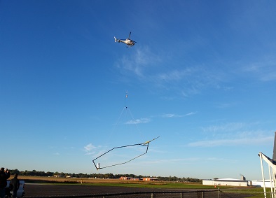
The Eastern Nebraska Water Resources Assessment (ENWRA) will conduct helicopter flights in mid-April. The helicopters are equipped with technology that captures a "cat scan" of the earth 900 feet below the surface. The data collected is used to identify aquifers.
The flights will take place at the Crete, Nebraska airport. Katie Cameron, survey hydrogeologist, said anyone from SNR is welcome to attend.
To learn more about the flights, refer to this recent news story featured on channel 10/11 news: http://www.1011now.com/home/headlines/Unique-Technology-Studies-Nebraska-Aquifers-297465781.html.
Contact Cameron at kcameron2@unl.edu or 402-476-2729 for more information.