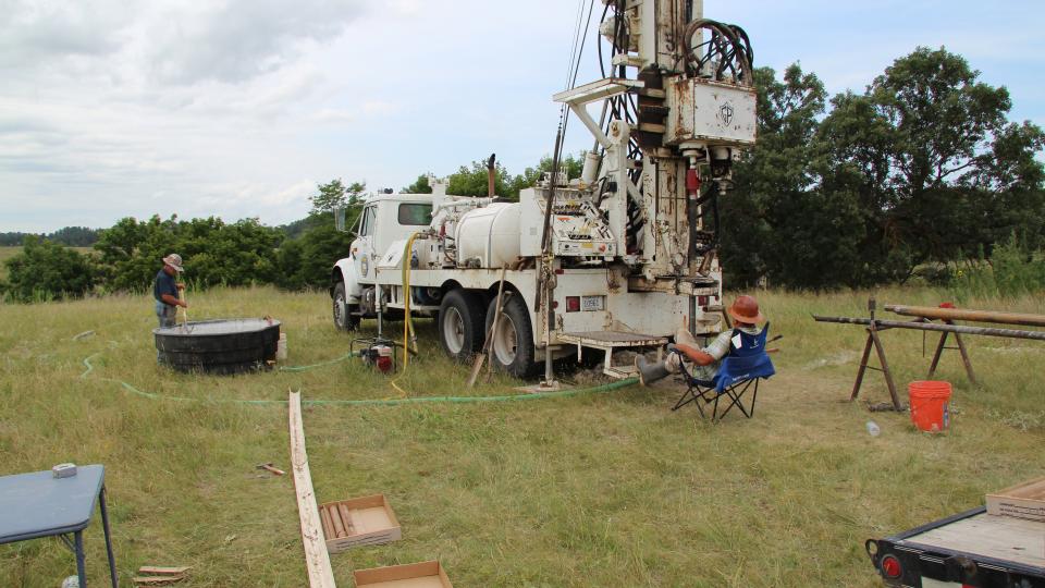
For more than 85 years, the Conservation and Survey Division in the University of Nebraska-Lincoln's School of Natural Resources has been home to one of the leading test hole drilling programs in the country.
"It is a somewhat unique program because of its longevity," said Matt Joeckel, Conservation and Survey Division director and Nebraska state geologist.
The Nebraska statewide test hole database contains information on about 5,500 test holes that have been drilled since 1930. These test holes provide researchers with valuable geologic and hydrogeologic data.
"Nebraska has a better picture of shallow subsurface geology by virtue of geological survey activities than many other states do," Joeckel said.
There are many ways to drill a test hole, a common one being the mud rotary method. In this method, drilling fluid -- a mixture of bentonite clay and water -- is pumped down the drill pipe and out through the ports or jets in the drill bit. That fluid then flows up the space between the hole and the drill pipe, carrying cuttings -- but not a continuous, intact sample -- to the surface.
"We do a lot of mud rotary test hole drilling at CSD," said Matt Marxsen, field service coordinator. "Using that method, our samples come out of the borehole mixed together, and in some of the formation, it's very difficult to interpret."
That's where wireline coring comes in. In this method, a continuous core is extracted from the depth of the test hole, as opposed to just the cuttings.
"With wireline coring, we can retrieve a fully intact sample, which has many times the information value than the cuttings alone," Joeckel said.
Although the CSD has had the capacity to perform wireline coring since 2005, the road to drilling that first hole has been a bumpy one.
"We attempted wireline coring roughly eight years ago," Marxsen said. "At the beginning, it was working great."
But as the team drilled deeper and hit different geological materials, the process failed.
"The drilling rig was not set up with the right pumping equipment," Marxsen said.
After receiving funding to make the necessary equipment upgrades, Joeckel said the team tirelessly studied wireline coring and readied themselves for another attempt.
"We had the equipment for a while," Joeckel said. "It was a matter of building up talent -- homegrown talent."
Each year, the CSD participates in a U.S. Geological Survey mapping project. Geologists pick quad maps that need to be mapped. This year, Joeckel selected the Cornell Dam Quad, east of Valentine near the Fort Niobrara Wildlife Refuge.
There, the team would try again.
In August, the CSD drilled a 443-foot test hole using the wireline coring method.
Marxsen, who led the drilling effort alongside research assistant John Seamann and student worker Jordan Shields, said the process had its ups and downs.
"The thing that surprised me the most was the quality and quantity of the core," Marxsen said. "I was unsatisfied with the time it took to perform this type of drilling, but the satisfaction of the quality of the core outnumbers anything else."
The remarkably intact core provides a "brand new glimpse into the geology of north-central Nebraska," Joeckel said.
For example, throughout the core there's evidence of ancient soils that are approximately 23-28 million years old. The core will likely provide new information about how climate and landscapes changed in ancient Nebraska during a critical period in the evolution of the Great Plains.
And that's just the beginning.
"As of right now, some of what we see in the core is a major challenge to interpret," Joeckel said. "And that’s a good thing."
Now, it's all about forging ahead -- or downward, depending on how you look at it.
"It'll be interesting to see how much deeper we can go in the future," Joeckel said. “It’s an exciting time."
— Mekita Rivas, Natural Resources