Higher winds, more T-storms keep birds confined to calm-eyed center of cyclones
by Scott Schrage | University Communication
Whether birds get caged in the eye of a hurricane may depend on the intensity and totality of the chaos beyond the calm, says a novel study from the University of Nebraska–Lincoln’s Matthew Van Den Broeke.
Reports of birds being trapped in the center of hurricanes date back to at least the 19th century, when crews observed the phenomenon from the bows of ships and saw their vessels become mobile ports for exhausted birds.
“It’s been really fun reading some of these older observations from the 1800s about taking a ship through a hurricane eye and watching birds landing on it,” said Van Den Broeke, associate professor of Earth and atmospheric sciences. “So we’ve known for a long time that this happens.
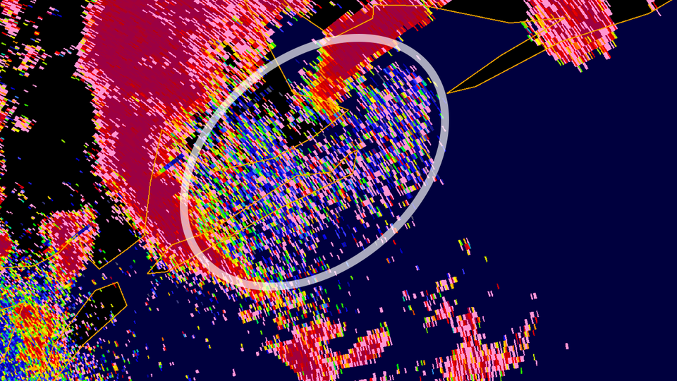
“But it’s really only since (the advent of) radar observations that we have gotten any sense of how many of these systems actually do transport birds and insects.”
The technology that allowed meteorologists to really begin differentiating weather from organisms — dual-polarimetric radar, which added a second, vertical dimension to previously one-dimensional observations — became widely available only in the past 10 years. Which means that much still remains unclear about when, how often and under what conditions a hurricane turns a free bird into a whirlybird.
Read more:
https://news.unl.edu/newsrooms/today/article/feather-phenomenon-radar-indicates-stronger-hurricanes-trap-transport-more/