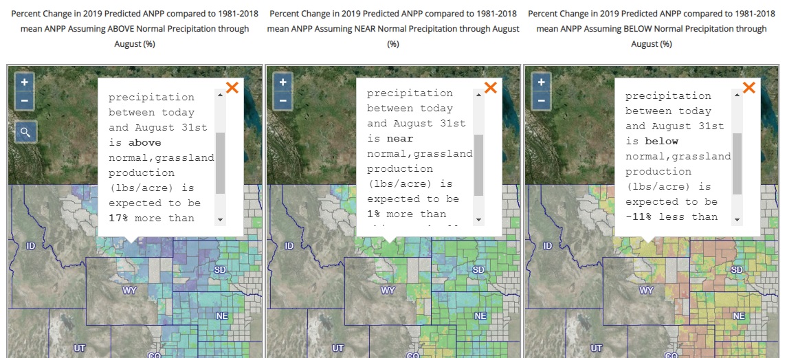
Every spring, ranchers must try to figure out how much grass will be available for livestock to graze during the summer. A tool that can help Great Plains-based producers make the best guess possible is now available on the National Drought Mitigation Center website.
The Grassland Productivity Forecast, or Grass-Cast, was developed in collaboration with Colorado State University, the U.S. Department of Agriculture, University of Arizona and NDMC, which is housed at the University of Nebraska-Lincoln School of Natural Resources. Colorado State originally hosted the product, which transitioned to the NDMC website this spring, just in time for ranchers to use the improved tool to make key rangeland decisions this spring.
Across the Great Plains’ 10-state region, Grass-Cast uses nearly 40 years of historical data on weather and vegetation growth, coupled with seasonal precipitation forecasts, to provide estimates of how productive rangelands will be in individual grid cells (about 6 miles by 6 miles apiece), depending on if precipitation over the growing season is above-normal, near-normal or below-normal.
Dannele Peck, Director of the USDA Northern Plains Climate Hub, said that Grass-Cast’s accuracy improves with time as the growing season unfolds, so it should be consulted more than just once during the spring and summer. The Grass-Cast maps areupdated every two weeks to incorporate newly observed weather data and emerging trends in the forecast, such as the flash drought that the western Dakotas and eastern Montana experienced in 2017.
The Grass-Cast tool should be combined with a landowner'sintimate knowledge of their landscape, including its unique characteristics and conditions at the local scale and how these differ from those at Grass-Cast’s coarser scale. Grass-Cast does provide a view of rangeland productivity across the broader region, to assist in larger-scale decision making—such as where grazing resources might be more plentiful if a rancher’s own region is at risk of drought.
Funding for this project was provided by the USDA Natural Resources Conservation Service (NRCS), USDA Agricultural Research Service (ARS), and NDMC. To view the maps, and watch a tutorial video explaining how to use them, visit grasscast.unl.edu.
NDMC Communications
More details at: https://grasscast.unl.edu/