by Geitner Simmons | IANR Media
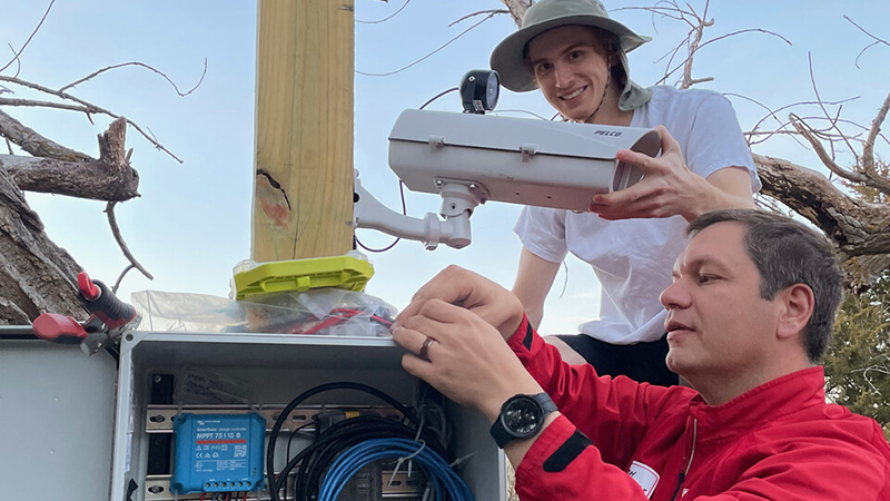
Scientists operate dozens of ground-based, time-lapse cameras to monitor water body conditions in the Platte River basin. They are among the 1,400-plus cameras monitoring the nation’s inland waterways, generating an enormous amount of visual data with great potential to boost environmental understanding.
A University of Nebraska–Lincoln and University of Nebraska at Kearney collaboration, known as the GRIME Lab, is developing software to process that avalanche of data.
Once data-management capability is achieved, scientists will have enhanced tools for environmental analysis, and the public can be better informed about factors relating to floods, ice jams, overall river conditions and water quality.
The image archives from time-lapse cameras “are rich with natural resources information, especially the dynamics of water resources and aquatic habitat, but the full value of these images is still unknown and untapped,” said Troy Gilmore, an associate professor with UNL’s School of Natural Resources and Department of Biological Systems Engineering.
Environmental scientists regularly visit lakes, rivers and streams to study their condition, but using data from time-lapse cameras “fills in those gaps between site visits and really brings out a lot of the dynamics that are happening when you’re not present,” said Gilmore, a groundwater hydrologist with the Conservation and Survey Division in the School of Natural Resources.
The GRIME Lab offers open-source software online known as GRIME2, standing for Gaugecam Remote Image Manager-Educational. The GRIME2 algorithms analyze water body imagery to automatically measure water levels by transforming image pixels to real-world values such as inches or centimeters.
Read the complete article and see more images at https://news.unl.edu/newsrooms/today/article/lab-boosts-understanding-of-water-bodies-creates-student-opportunities/