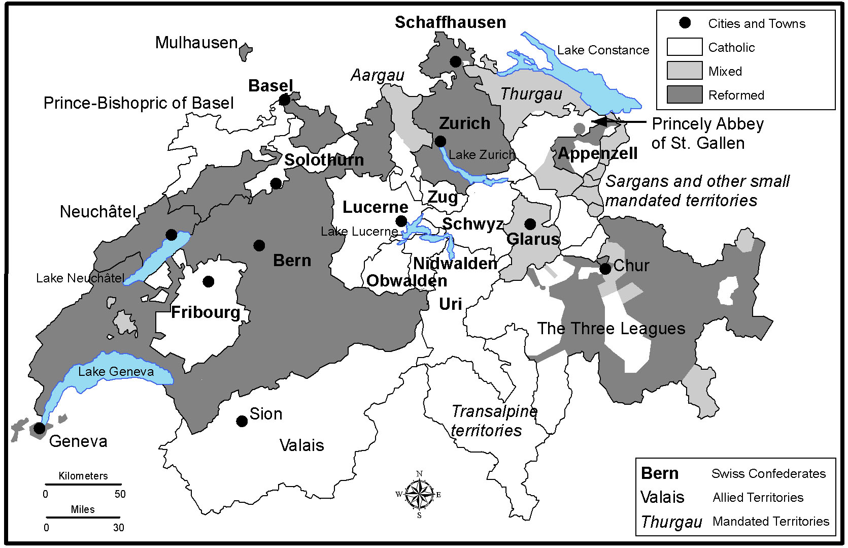
University of Nebraska-Lincoln history professor Amy Burnett and SNR geography doctoral student Glenn Humphress recently collaborated on a book on the Swiss Reformation, with Humphress producing five maps to illustrate essays in the volume.
The book, A Companion to the Swiss Reformation, published by Brill Publishers, was co-edited by Burnett and contains essays examining characteristics of the Protestant Reformation as it occurred in the Swiss Confederation during the 16th century.
Humphress' developed maps depicting the region's physical landscape, the political divisions for all or parts of the Swiss Confederation at particular times during the 16th Century, and the religious divisions that existed by the 17th Century.
The maps draw upon a variety of historical and recent sources, in consultation with the editors and chapter authors, Humphress said. The historical political and religious boundaries depicted on the maps were not readily available in digital form and had to be created from scratch, using a geographic information system program, ArcGIS. Drawing boundary lines and creating underlying databases took the bulk of the time Humphress spent on the project, which began in the fall of 2015. The remainder of the time was devoted to developing the maps that ultimately appeared in the book, after several revisions, by adding shading or color and the requisite cartographic elements, such as legend, labels, scale and compass rose. The final maps were delivered in May 2016. The book was published in July and will be translated into German in 2017.
“As a geographer with a background in history, this was an interesting and fun project,” Humphress said. “I also enjoy the artistic challenge inherent to cartography of taking a blank page, so to speak, and creating a visual form that effectively communicates the desired geographic message.”
“Seeing my first maps in print is exciting,” he added, “a highlight of my career so far.”
In addition to pursuing his doctoral degree with SNR, Humphress works with the Center for Advanced Land Management Information Technologies at the School of Natural Resources.
-- Natural Resources