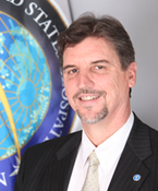
R. Maxwell Baber, director of Academic Programs at the U.S. Geospatial Intelligence Foundation in Herndon, Va., will present a geography seminar on "Geospatial Intelligence: Deriving Knowledge from Data for National Security and Beyond" at 2 p.m. Friday, Jan. 20, in 901 Hardin Hall.
Abstract
Geospatial data and technologies are now fundamental to U.S. intelligence capabilities, and the United States Geospatial Intelligence Foundation (USGIF) supports a robust and growing Geospatial Intelligence (GEOINT) community of government and industry partners. For the GEOINT community, the national security mission is broadly defined beyond defense activities, to include responses to humanitarian crises, natural disasters, and climate change. USGIF is cultivating the next generation of GEOINT professionals with scholarships and collegiate program accreditation, to assure a geospatially-enabled workforce prepared for evolving challenges in this dynamic field. USGIF advocates a multidisciplinary approach to problem-solving with geospatial science and technology, promoting geospatial capabilities across all scientific disciplines (physical and social). Students are encouraged to prepare for a future where geospatial technologies are ubiquitous and integral to success in an increasingly competitive global economy.
Biographical Sketch
Max Baber is director of Academic Programs at the United States Geospatial Intelligence Foundation (USGIF), stewarding accreditation of university Geospatial Intelligence (GEOINT) certificate programs and supporting related academic initiatives. Baber received a Ph.D. in Geography from the University of Georgia in 1999 and an M.A. in Geography from Georgia State University in 1993. He has served in faculty appointments with the Master of Science in Geographic Information Systems program at the University of Redlands and Departments of Geography at Samford University and the University of Northern Colorado. He has developed and implemented a number of pedagogical geographic information science projects supported with funding from a number of sources, including the National Science Foundation. He serves on the board of directors for the Cartography and Geographic Information Society (CaGIS), is a member of the U.S. National Committee to the International Cartographic Association, and is a Fellow of the British Cartographic Society (BCS).
More details at: http://snr.unl.edu/geographygis/students/seminars.asp