The University of Nebraska-Lincoln Libraries GIS Day Map Competition aims to foster a deeper appreciation for GIS, encourage spatial thinking, and showcase the power of maps in understanding our complex world. Participants will showcase their creativity and analytical skills by creating innovative and informative maps that highlight various aspects of our world or even fictional realms.
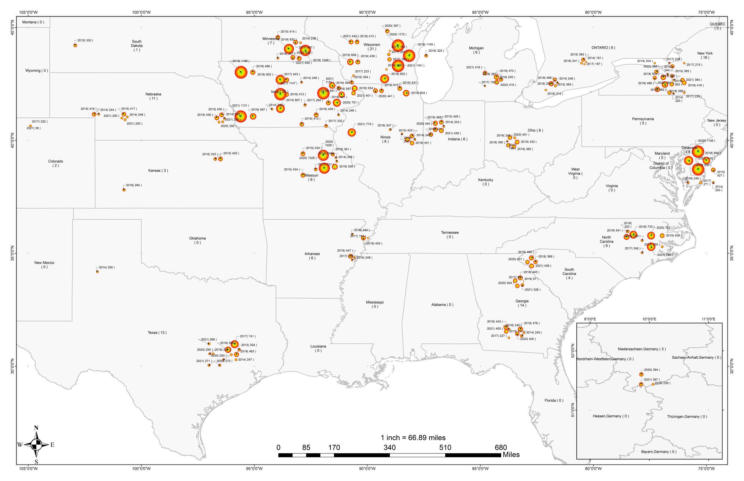
Map Title: Spatial Distribution of Phenotypic Records used in GxE model
Author: Hasnat Aslam
Description: The spatial distribution of phenotypic records (including “Plant height (cm)”, “Ear height (cm)”,“Grain moisture (%)”, and “Grain yield (bu per acre)”) of G2F ("G2F is an umbrella initiative to support translation of maize genomic information for the benefit of growers, consumers and society. This public-private partnership is building on publicly funded corn genome sequencing projects to develop approaches to understand the functions of corn genes and specific alleles across environments.") experiments in the US regions and the province of Ontario in Canada between 2014 and 2021. The state of Lower Saxony in Germany includes the years 2018, 2020, and 2021 for three locations. The location of each station on the map was modified for visualization purposes, allowing the illustration of stations with multiyear records. The size of the circle represents the number of years sampled, which also appears within the parentheses next to the year at each site. The colors of the circles were included for visualization purposes only.
More details at: https://unl.libguides.com/unlgisday/mapcompetition